Wet spell to intensify across J&K, peak activity likely on March 29–30: IMD

Srinagar, March 27, KNT: A prolonged spell of wet weather is set to impact large parts of India over the coming week, with peak activity expected on March 29 and 30, the India Meteorological Department (IMD) said on Friday.
The weather system is expected to bring intensified precipitation across Jammu and Kashmir and Ladakh, raising the likelihood of disruptions in higher reaches.
The advisory comes as a fresh western disturbance begins to influence the region, with conditions expected to worsen over the next 48 hours before peaking over the weekend.
According to IMD, light to moderate rainfall and snowfall is likely over Jammu and Kashmir and Ladakh on March 27, which will intensify into fairly widespread precipitation between March 28 and 30.
The Kashmir Valley is likely to witness isolated heavy rainfall and snowfall on March 30, increasing the risk of disruptions in transport and daily activities.
The forecast indicates a gradual build-up of cloud cover from March 28, followed by active precipitation phases, particularly on March 29 and 30.
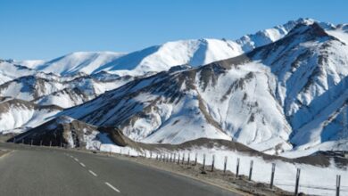
Higher reaches are expected to receive snowfall, while plains may witness intermittent rain, officials said.
The wet spell is expected to impact road connectivity in vulnerable areas, especially along mountain passes and higher altitude routes.
Authorities have advised people to remain cautious, particularly in areas prone to landslides, avalanches and waterlogging.
The weather activity is part of a broader system affecting northern India, with multiple regions expected to receive rainfall during the same period. [KNT]